Cajón del Maipo from Santiago: The Turquoise Reservoir, the Unpaved Last Stretch, and Empanadas Going Up
Two hours southeast, the canyon climbs to a turquoise reservoir at 2,500 meters — the last stretch unpaved, winter demanding chains or closing it outright, and most travelers wisely taking the tour.
The short version
- The canyon runs 90–120 minutes southeast of the capital, with the Embalse el Yeso’s final approach on unpaved mountain road — winter snow closing or chain-gating it per the alarm, and the guided-tour format the standing answer for travelers without mountain-driving appetite.
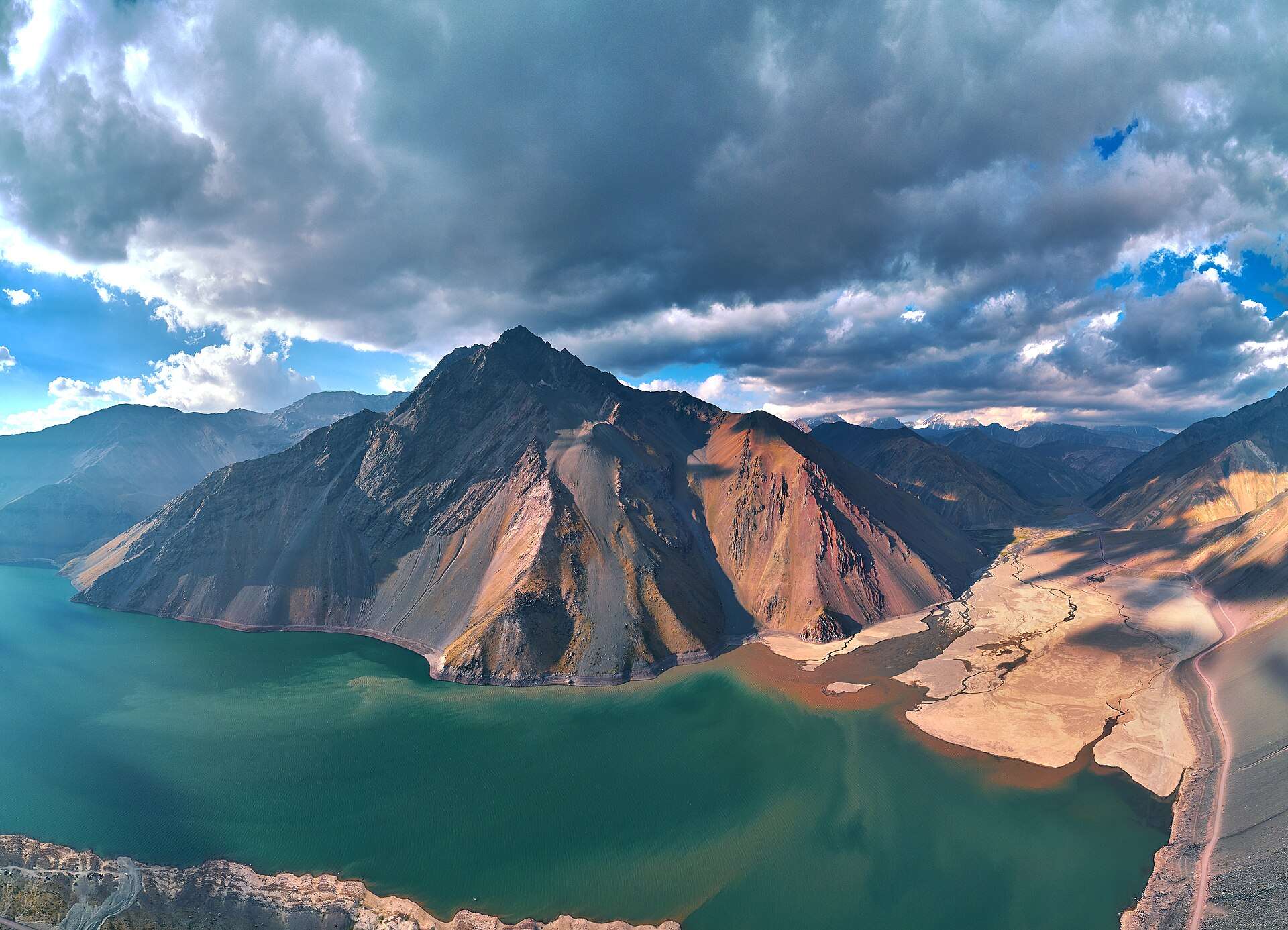
- The reservoir is the headline the alarm named: glacial-fed water at roughly 2,500 meters turning mineral turquoise against bare Andean slopes — Santiago’s drinking-water storage, which explains both the color’s purity and the no-swimming rules around it.
- San José de Maipo anchors the valley’s town tier: the plaza, the empanada institutions the alarm scheduled for the ascent, and the mountain-town pace that makes the mid-valley stop more than a fuel break.
- The German-Alpine streak per the alarm is real: kuchen, küchen-adjacent pastry cases, and chocolaterías thread the valley’s villages — the descent’s coffee stop writes itself.
- The wider canyon menu runs by season and appetite: Baños Morales’ rustic thermal pools and the Monumento El Morado glacier-valley hike in the warm months, the farther Termas Valle de Colina’s terraced hot springs for the long-day version, and roadside miel-and-mote stands year-round.
- The altitude and sun rules apply in full: 2,500 meters works on lowland arrivals, the Andean sun doubles at the reservoir’s latitude of bare rock, and the alarm’s pack-like-it-means-it clause covers water, layers, and sunscreen regardless of season.

Getting there
The tour-versus-rental fork per the alarm is the day’s one real decision: tours handle the unpaved stretch, the winter chain rules, and the reservoir’s timing turnkey; rentals buy overlook freedom at the price of mountain-road judgment and a same-day weather check (the road’s status changes with storms, and winter can close el Yeso outright). Either way the shape holds: morning ascent with the San José empanada stop, reservoir midday, valley stops descending. Fuel up before the canyon; services thin past San José.
The day
The ascent works the canyon’s narrowing drama — the Maipo’s rapids below, the walls closing, San José’s plaza and empanadas per the alarm at the mid-morning pause — then the pavement ends and the switchbacks climb to el Yeso’s bowl: the first full view of the turquoise is the day’s photograph, and the shoreline pull-offs frame it against scree and snowline by season. An hour of strolling, staring, and picnicking covers the reservoir honestly; the altitude per the alarm keeps the pace gentle. The descent distributes the extras: Baños Morales’ pools and the El Morado trailhead in season for the hike-inclined, the kuchen stop the alarm promised at whichever chocolatería wins the vote, and the roadside honey stands for the take-home. Summer adds rafting put-ins on the lower Maipo for the adrenaline tier. The return lands Santiago by early evening, sun-tired in the way the canyon intends.
When to go
October through April runs the full road and the reservoir at its most reliably reachable — high summer (December–February) delivers the deepest turquoise under the hardest sun, per the alarm’s pack-accordingly clause. Winter (June–August) turns the canyon alpine: snow scenery, chain requirements or closures on the el Yeso stretch, and tours that swap the reservoir for lower-valley snow play when the road says no. Spring melt swells the river for rafting season’s start; autumn colors the poplars along the ascent. Every season shares the same morning rule — the light and the road both favor early.
Frequently Asked Questions
Can I really not drive it myself?
You can — with a suitable vehicle, a same-day road check, and mountain-gravel comfort; the unpaved stretch is regularly driven by ordinary cars in dry summer conditions. The alarm’s most-take-the-tour honesty reflects the median traveler: winter chains, weather swings, and rental-contract fine print make the guided version the lower-stress answer for most.
Why is the water that color?
Glacial rock flour — fine mineral sediment suspended in meltwater — scatters light at the turquoise end, and the reservoir’s purity (it’s Santiago’s supply) keeps the effect vivid. The color peaks with summer melt and midday sun. It also explains the rules: no swimming, no shoreline camping, the watershed protected accordingly.
Are the hot springs worth adding?
Baños Morales works as the rustic in-day add in season; the Termas Valle de Colina — terraced natural pools farther up a rougher road — is the standout but effectively demands the full-day-plus commitment or an overnight. Day-trippers pairing el Yeso with Colina discover the canyon’s distances are Andean, not urban.
What’s the German bakery story?
Alpine-style settlement and tourism seeded the valley’s kuchen tradition, and the villages leaned in — pastry cases, chocolaterías, and mountain-lodge aesthetics that read more Bavaria than the latitude suggests. It’s now simply the valley’s identity, per the alarm’s it-is-real clause, and the descent coffee stop is the correct tribute.
Cajón del Maipo or Valparaíso from Santiago?
Valparaíso (documented on this network) for port-city color and funiculars toward the coast; the Cajón for Andean altitude in the opposite direction. Sea level versus 2,500 meters — winter answers it (the coast stays open when the reservoir road closes), and summer’s heat argues the mountains by ten degrees.